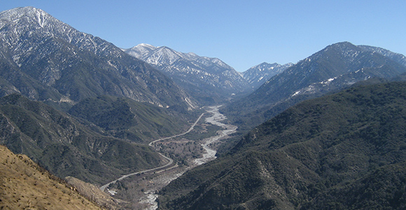
Mill Creek, one of the main headwaters tributaries of the Santa Ana River. (Photo Credit: jcookfisher/Flickr)
The hidden groundwater supply under our feet has extraordinary importance to California’s economy and our quality of life. It’s become the savings account that we’ve been drawing on to get us through this period of drought.
Under normal circumstances, about 35 percent of the state’s water supply comes from groundwater sources; today this has increased to 64 percent. Sadly, this means many of our groundwater reserves are being quickly depleted.
It is unfortunate but true that many local land use decision makers have been and continue to be unaware that the decisions they make have been contributing to the overdraft problem, making the situation even more serious than it needs to be. It is time to take a hard look at this.
Understanding Groundwater Terminology
Groundwater is defined as water located beneath the surface in soil pore spaces and in the fractures of rock formations. It can be found in many locations.
The largest quantities of groundwater are located in aquifers — the term used for basins deep in the ground that are lined with rock or sediment. Aquifers come in different sizes; some of the largest provide water to multiple cities and counties.
Aquifers are naturally filled when rainwater and urban runoff are absorbed into the soil. Some soils have exceptional porosity, permeability and transmissivity, allowing them to function as groundwater recharge areas. Groundwater recharge areas are located in or near river or stream bottoms but are also found in locations that are not near a stream. These special places play a critical role in our quest to maintain a balance between deposits and withdrawals from our important underground water savings accounts.
Watersheds are also important in the recharge of aquifers. Watersheds are made up of up-stream lands that collect snow runoff and rainwater from upper creeks and rivers and deliver it to lower elevations where the water collects and can be absorbed into the ground.
How Development Impacts Groundwater Supplies
According to the U.S. EPA, a relatively undisturbed working landscape can capture 50 percent of the water than falls on the ground, with half of it reaching deep-water aquifers. The remainder collects in shallow soils or evaporates. The rate of capture is reduced with every increase in impervious cover – that is the more roads, parking lots, and other structures covering the land, the less water penetrates the ground. When the amount of cover exceeds 10 percent of the land, the ability of nature to replenish groundwater supplies begins to be compromised.
In 2014, Texas A&M documented the rapid development that had been happening throughout Texas, replacing open lands with roads, parking lots, subdivisions, malls, and the like. Researchers reported that sprawl development had resulted in a loss of 1.1 million acres of open ground between the years of 1997 and 2012, covering many potential recharge areas that the report’s authors, say, “are vital to the State’s water supply.”
Another research project took this concern a few steps further, to estimate the gallons of groundwater that is being lost due to sprawl development throughout the country. The final report, “Paving Our Way to Water Shortages: How Sprawl Aggravates Drought“ (published in 2014 by American Rivers, the National Resources Defense Council and Smart Growth America) documents the acres of potential recharge areas covered over between 1982 and 1997 in 20 cities, then models the gallons of groundwater per year that that each has lost to urban development. The results ranged from an average loss of about 10 billion gallons annually in Dallas, Texas to 100 billion gallons in Atlanta, Georgia.
Economics of Groundwater Protection
Back in 1962, researchers from the Texas Board of Water Engineers and U.S. Geological Survey studied the economics of removing two large, floodwater-retaining structures from a groundwater recharge area for the purpose of capturing an additional 20 percent of runoff. They then calculated the cost effectiveness of this action by calculating the value of the additional water that would be retained as groundwater if they moved the structures away from the recharge zone. It added up to $7,500 every year for 50 years.
It is instructive to consider the amount of money that the loss of inexpensive, naturally replenished groundwater could be costing us today. Consider that the average annual infiltration loss from aquifers in Atlanta due to sprawl is estimated to be 100 billion gallons. In the unlikely case that the residents and businesses in the City had to pay the same price for water as it costs to purchase it from a grocery store, losing 100 billion gallons of relatively inexpensive groundwater would cost the population of Atlanta almost $122 billion dollars every year.
Of course wholesale water rates are currently far less than the price of bottled water at Safeway. Further, the price of water varies depending on where one lives. One thing is certain, however – as water becomes increasingly scarce, the price to the consumer will keep going up. San Francisco and Fresno have already announced that they will be doubling their rates over the next 3 to 5 years. Just in the past few months the cost of water to farmers in Orange Cove has risen from $90 to $1,500 per acre-foot!
Early Advice From DWR
Back in 2009, the final draft of the Department of Water Resources’ California Water Plan included a recommendation that city and county general plan processes include a discussion of the cost and value of protecting recharge areas versus the cost of non-protection.
Additional forward-thinking measures were included in the plan:
- Develop a statewide program to identify actual and potential recharge areas throughout the state and provide that information to Tribal, city and county governments.
- Amend State law to prohibit local decision-makers from developing land for other purposes until it is known if that land is needed for recharge as a part of the local agency’s groundwater management plan.
- Engage the public in an active dialogue using a value-based decision-making model in planning land use decision that involve recharge areas.
- Establish a “Water” element in the General Plan process that specifically requires a discussion by local government of the cost and values of protecting recharge areas versus the cost of non-protection. Eminent domain should not be allowed to convert potential recharge areas to other uses.
- Require local government to provide protection of recharge areas for aquifers that have been identified as “sole source aquifers.”
A Few Local Jurisdictions Have Moved In This Direction:
Over the years, there has been little, if any, coordination between the water agencies that are responsible for delivering our water and the local governments that have the ability to guide and control land use. Fortunately there are a few successful projects that can serve as models:
New York: This region is well known for its protection of its watershed and an agreement among 70 towns, eight counties, and the EPA. The city-funded, multi-year agreement, multi-faceted land conservation approach, includes the purchase of 80,000 acres of working landscapes to protect the city’s water supply. The $1.4 billion agreement allowed the city to avoid the construction of filtration facilities estimated to cost six to eight billion dollars by simply allowing natural processes to cleanse the water.
City of Austin: In 1980, the City of Austin adopted measures that protect the recharge zones of aquifers under its jurisdiction. Eight zoning ordinances protect eight individual recharge areas. The policies address impervious cover, density, and transfer of impervious cover or development rights, storm water treatment and detention requirements, construction site management and stream setbacks or buffer zones.
Santa Ana Watershed Project Authority: This joint powers effort includes five major water resources agencies, three counties, and multiple cities located along the same aquifer and watershed, ranging from the Inland Empire to Orange County. The authority undertakes collaborative planning and implementation activities with multiple agencies and organizations throughout the region. One of these joint efforts brings together city and county planning department staff and watershed stakeholders, an important first step toward developing a system-wide, integrated approach to assuring that groundwater recharge areas are not paved over.
Santa Clara Valley Open Space Authority: has completed a first-ever economic valuation of the open space in its jurisdiction. Their document, Healthy Lands and Healthy Economies, Nature’s Value Santa Clara County, notes that 60 percent of the landscape that once recharged groundwater in Santa Clara County is now paved over. The authors have identified the remaining 40 percent, a critical first step in avoiding any further losses.
The Authority secured maps of the groundwater basins boundaries from the Santa Clara Valley Water District. To identify recharge areas that are already lost to development, the researchers overlaid groundwater basins maps with data obtained from the California Department of Conservation’s Farmland Mapping and Monitoring Program. This exercise allowed the Authority to determine which recharge areas have already been developed and pinpoint the remaining, precious, recharge zones that need to be preserved.
Piling On The Co-Benefits
There is more than one benefit to protecting groundwater recharge zones. Besides replenishing our groundwater supplies, these measures can also assist flood control reduce water pollution, and more.
Flood Control
In Fresno, the Metropolitan Flood Control District collects stormwater in basins that both act as flood control mechanisms and allow water to recharge the aquifer — the county’s primary source of drinking water. Several basin sites also double as recreational areas.
The Reduction of Water Pollution
Urban runoff is the largest source of water pollution. As rainwater and irrigation water flows over streets and parking lots, it gathers up contaminants and delivers it to our water bodies.
EPA water experts have concluded that higher density scenarios provide the best option for reducing water pollution from urban runoff because they reduce the urban runoff per house and per lot. At the same time, more compact development is an important strategy for preserving groundwater recharge areas. It should be noted that California’s land use legislation (AB 859) currently encourages compact development and the preservation of undeveloped open space.
Moving Forward
Ever since 2009, there has been continual but limited attention given to groundwater recharge by both the California Department of Water Resources (DWR) and the California Legislature, however California’s four-year drought has brought this issue into laser-like focus.
In September 2014, Governor Brown signed historic legislation requiring that California’s critical groundwater resources be sustainably managed by newly created Groundwater Sustainability Agencies made up of representatives from cities, counties and water districts. These new Agencies are charged with preparing Groundwater Sustainability Plans to assure that our precious groundwater supplies are sustainable for the long term. Achieving sustainability will require these agencies to balance water withdrawals with “water deposits,” bringing groundwater recharge front and center.
Groundwater Sustainability Agencies will be formed around shared water basins not political jurisdictions. In some cases, this is going to require cities, counties and water agencies that share the same aquifer to jointly produce a Groundwater Sustainability Plan (The unique partnership established by the aforementioned Santa Ana Water Project Authority may be a useful model for other jurisdictions to follow).
The Department of Water Resources is currently working to both define the borders of the State’s groundwater basins and produce guidelines for the preparation of Groundwater Sustainability Plans. Local governments and stakeholders sharing the same groundwater basin will then have until June 30, 2017 to form Groundwater Sustainability Agencies.
The Groundwater Sustainability Agencies in charge of critically over-drafted basins must complete a Groundwater Sustainability Plan and submit it to the Department of Water Resources by January 31, 2020. All other Groundwater Sustainability Agencies are required to submit their plans by January 31, 2022.
Why Local Governments Should Start Planning Today
While many have applauded the Groundwater Sustainability Management Act of 2014, there is also recognition that a great deal of land could be paved over and aquifers over-drafted as we wait for the Groundwater Sustainability Agencies to complete their plans.
Asked what she believes local governments can do to address the immediate threat, Celeste Cantu, former Executive Director of the State Water Resources Control Board and now General Manager of the Santa Ana Watershed Project Authority, recommends that cities and counties establish a “W” zone around every important aquifer recharge area in their jurisdiction in order to control development of this precious ground.
Existing law (AB359, Huffman) states that to be eligible for infrastructure grants from the Department of Water Resources, water agencies must provide a map of important recharge areas to local planning agencies. This information should be enough to allow local governments to locate functioning aquifers. Overlaying water agency maps with maps from the California Department of Conservation’s Farmland Mapping and Monitoring Program will allow local governments to locate the aquifers within their jurisdiction that are still functioning, per the technique pioneered by the aforementioned Santa Clara County Open Space Authority.
If local governments can identify and save our natural recharge areas today, it will help reduce economic pain and costs in the future. Otherwise, if and when the drought continues, we will have to resort to even more drastic anti-drought spending and herculean conservation measures. It’s a simple matter of an ounce of prevention being worth a pound of cure.
Judy Corbett is Innovation Advisor for the Local Government Commission and member of the California Economic Summit Working Landscapes Action Team.